This winter break I had the opportunity to sneak my KX2 on a family vacation. I activated KH6/MA-001, MA-003, and MA-009. I’ll detail my hikes, tips, and contacts for the trip. I’ll go chronologically from my first activation (MA-003) to my last (MA-001) with MA-008 and MA-009 thrown in.
Disclaimer
Every hike I attempted, save MA-001, was a challenge. I’m used to 7-8 mile R/Ts from the Catskills with 2,000ft of elevation gain, but these hikes took it to the next level. It took many Mai Tais to relax after these hikes. For reference, I’m an ultramarathoner and triathlete. Some of these were more challenging than a half marathon. Try these at your own risk.
Additionally, land use and ownership is a topic of debate in Hawaii. The state prohibits “bushwacking” of any kind, so you can’t simply dead reckon to the summit. However, you do not need to stick to marked trails. You may take pre-established goat trails up to the top. Pay careful attention to rock cairns and cuts on the way up and you should be fine.
KH6/MA-003: 8432
The Summit
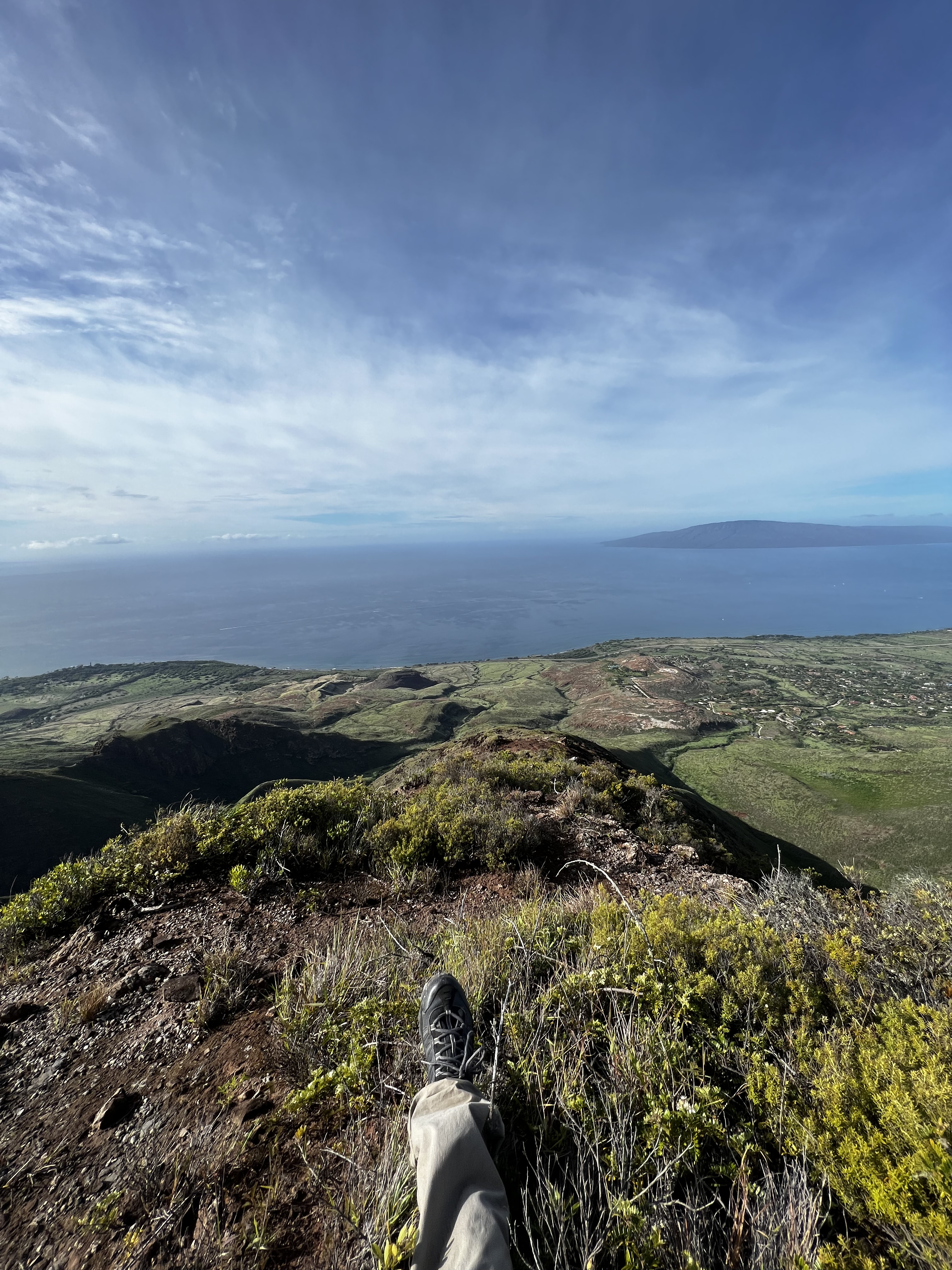
Summit 8432 is an unnamed summit in the Haleakala National Park of Maui. It is the southeast part of the island, and relatively close to Red Hill, the highest peak on the island. It offers great views of the southern islands but is tucked away in the park, relatively inaccessible to most tourists.
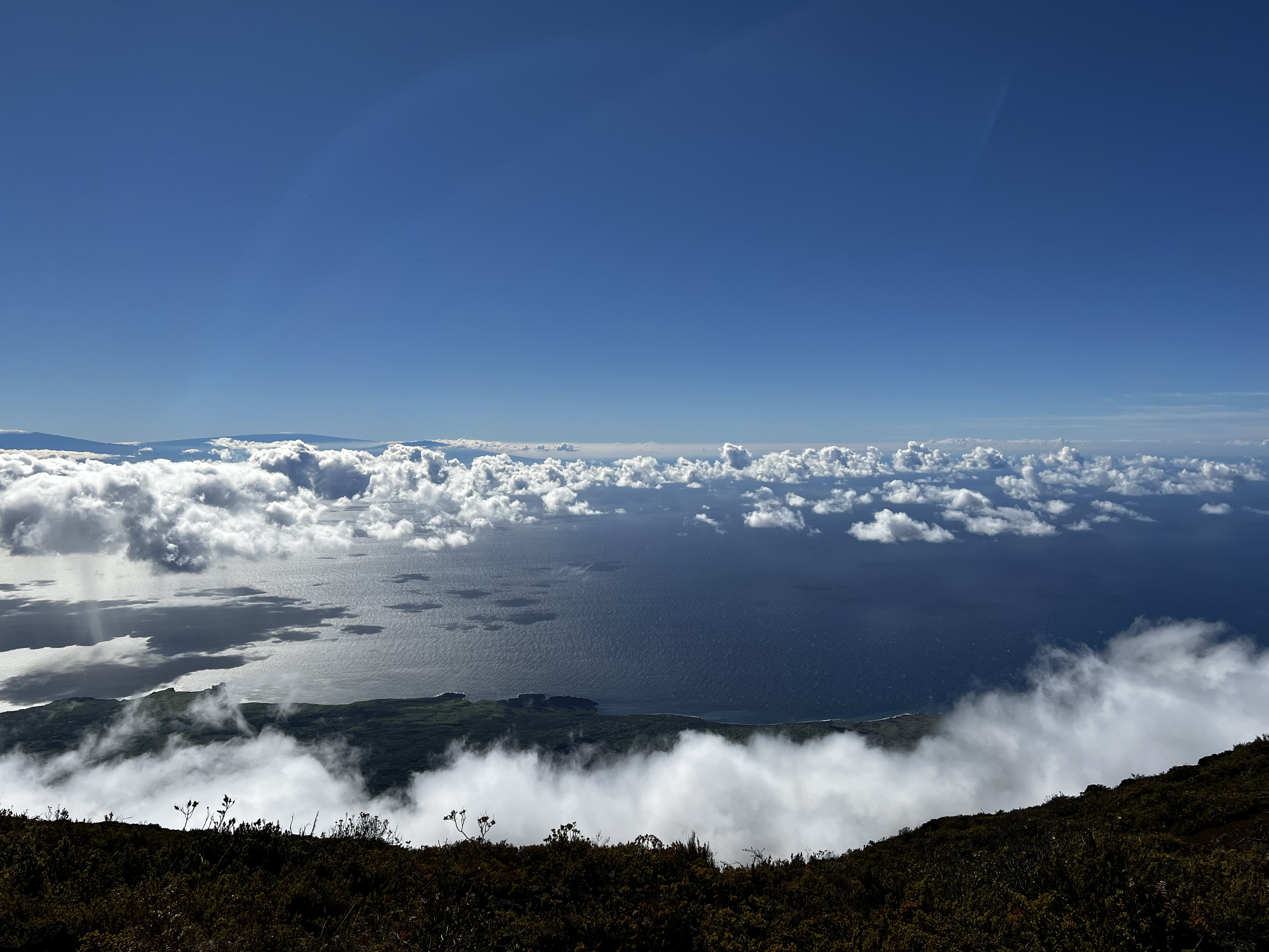 Summit View from the Top
The Hike
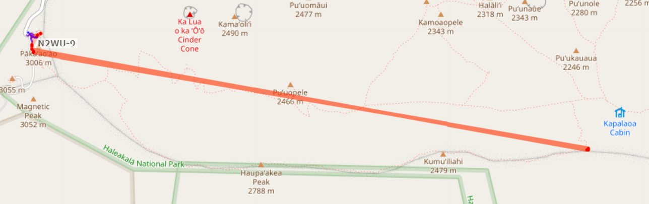
8432 was one of the longest, more painful hikes I’ve been on. Start at the Red Hill visitor Center at the summit of MA-001, then find the Sliding Sands Trail. You will continue for about 12 miles on this trail.
 Starting the Sliding Sands Trail
You’ll start on a descent, which is fun at first. You get lowered into a canyon which is sandy and hotter than the surrounding area:
 At the base of the canyon
After 4 miles, you’ll reach a turn sign. Keep going to Kapalaoa:
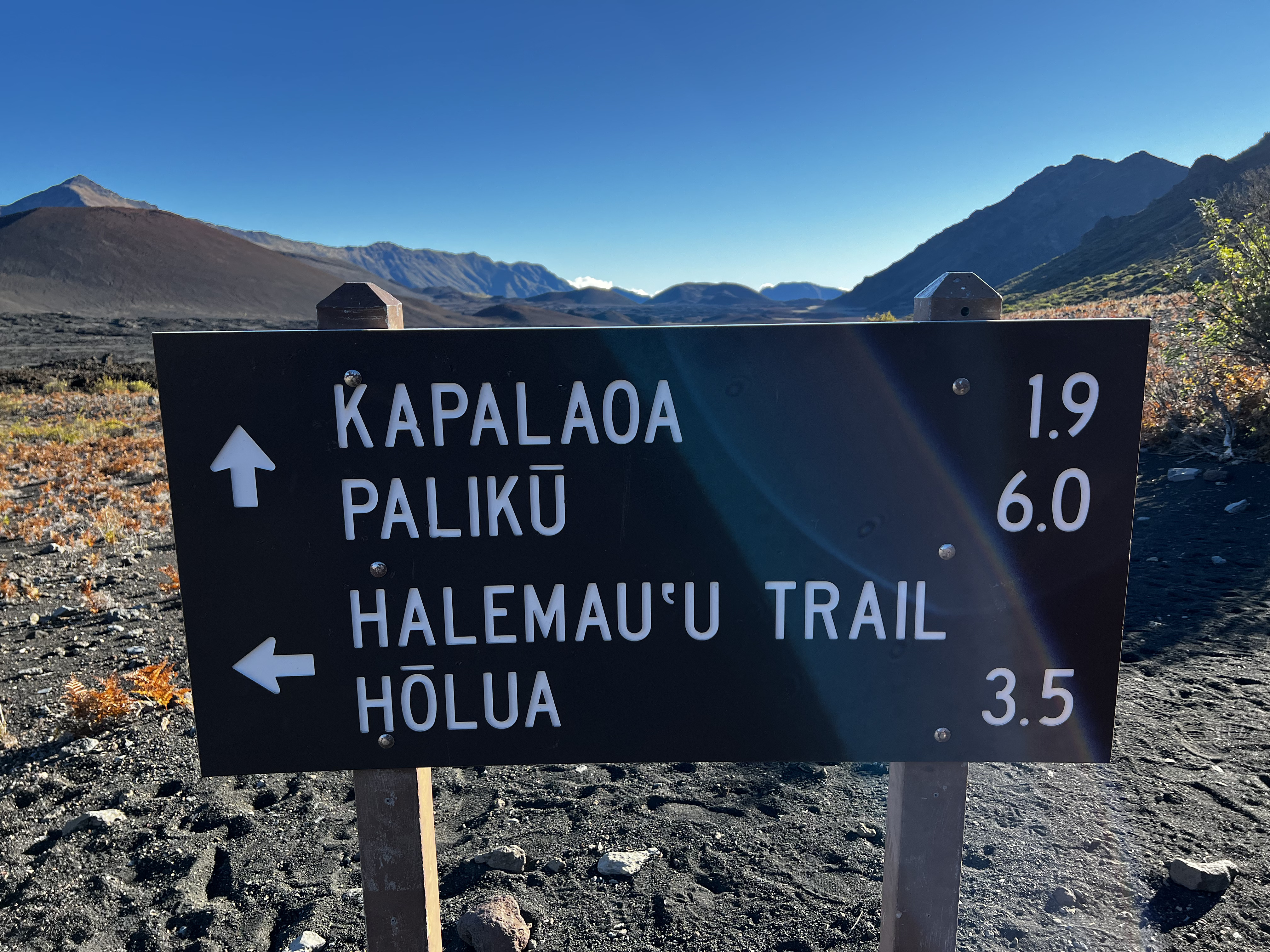 Trail Sign
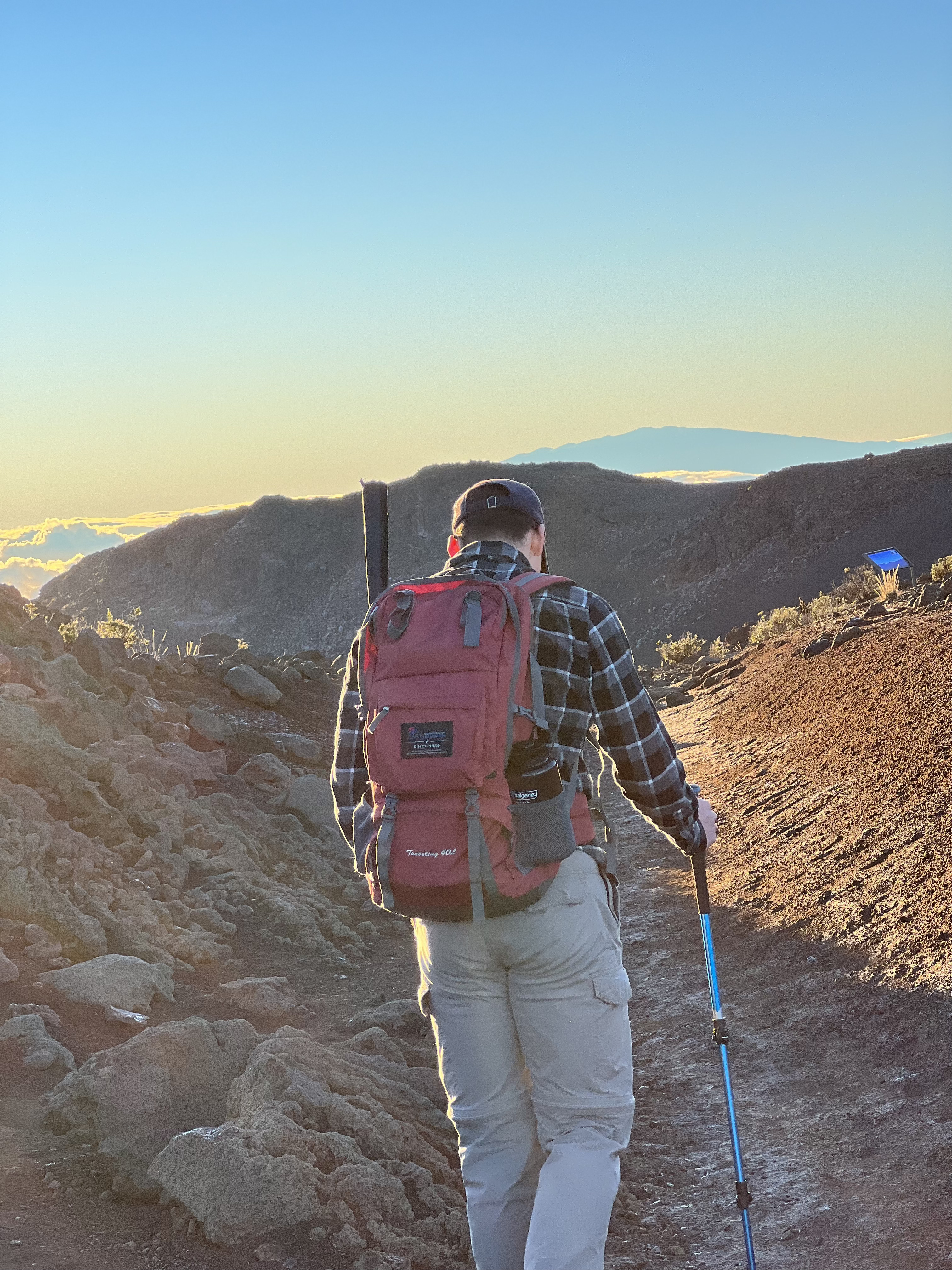
Look to your right. That’s 8432, and you’re going to have to find a way up. Continue for 1.5 miles until you see what looks like a dried-up riverbed. It’s very obvious where it is. Because there are footprints, signs of human activity, and cairns along the route, we climbed up this way. I would rate it class 3-4 as we were scrambling for much of the way and using more advanced mountaineering / hillwalking techniques. Thankfully it’s rather short with only an hour of scrambling.
 Scrambling up the trail
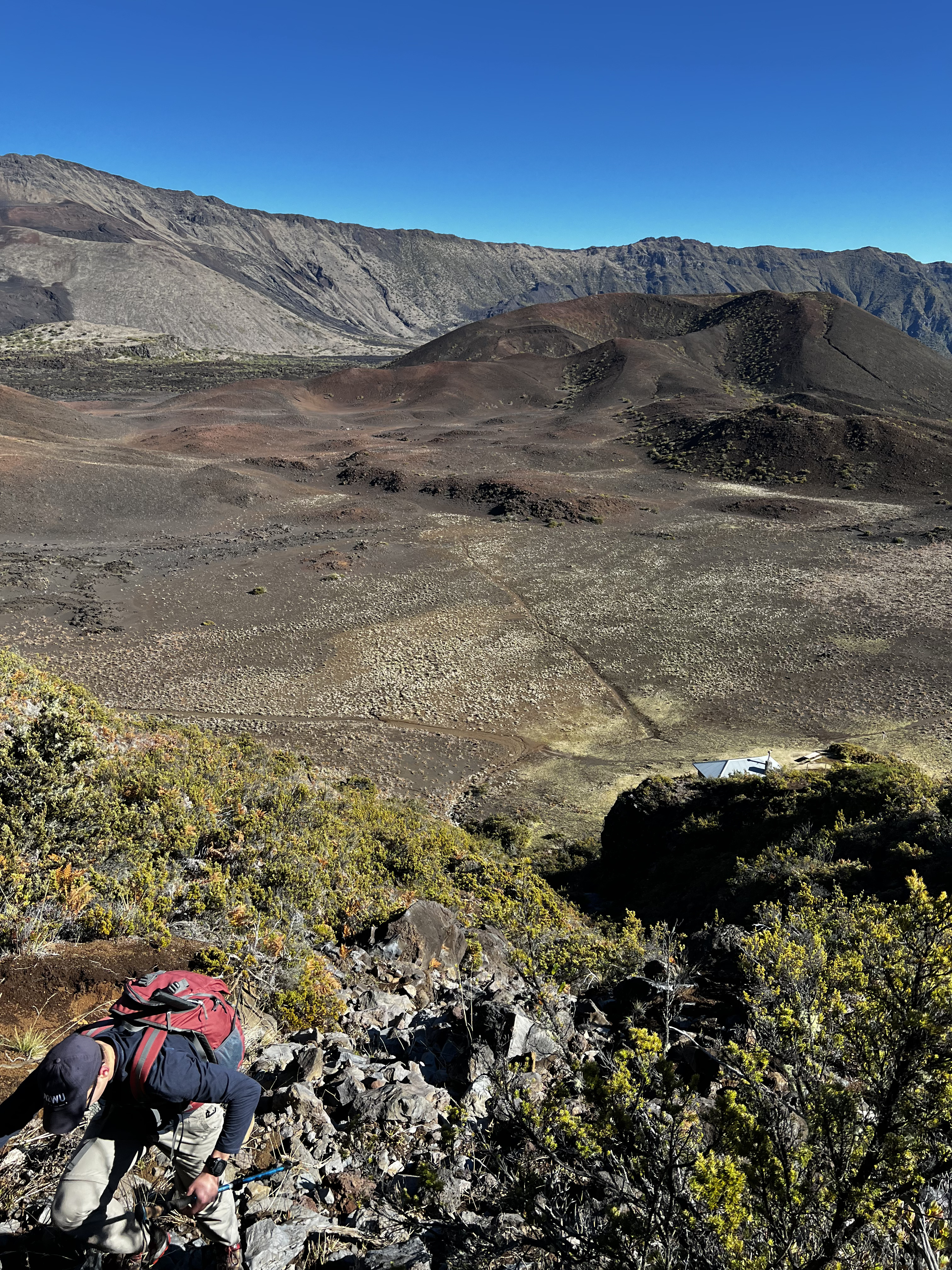
If you want, continue past this mark to the Kapalaoa cabin. You’ll see a sharp ridgeline of 8432:
 Ridgeline
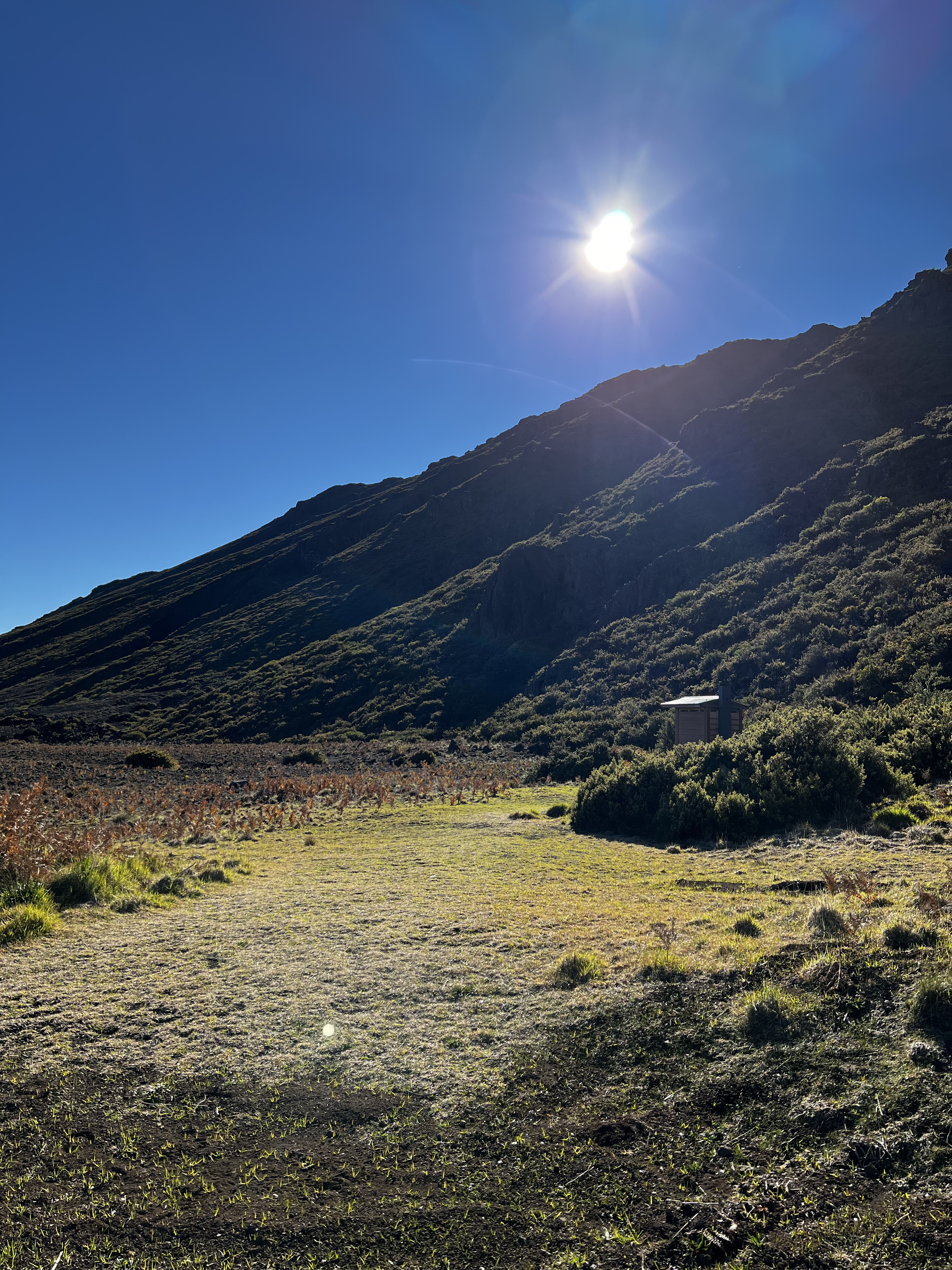
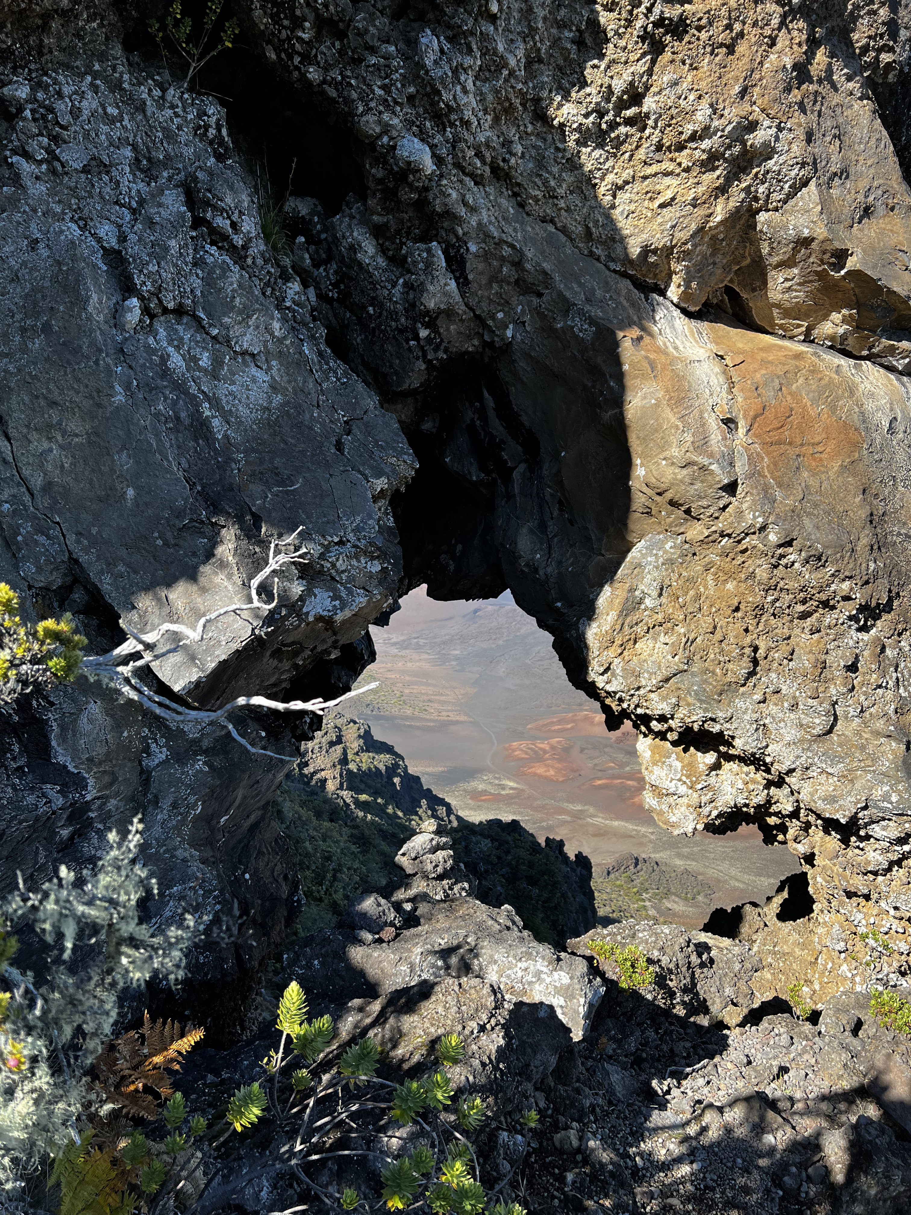
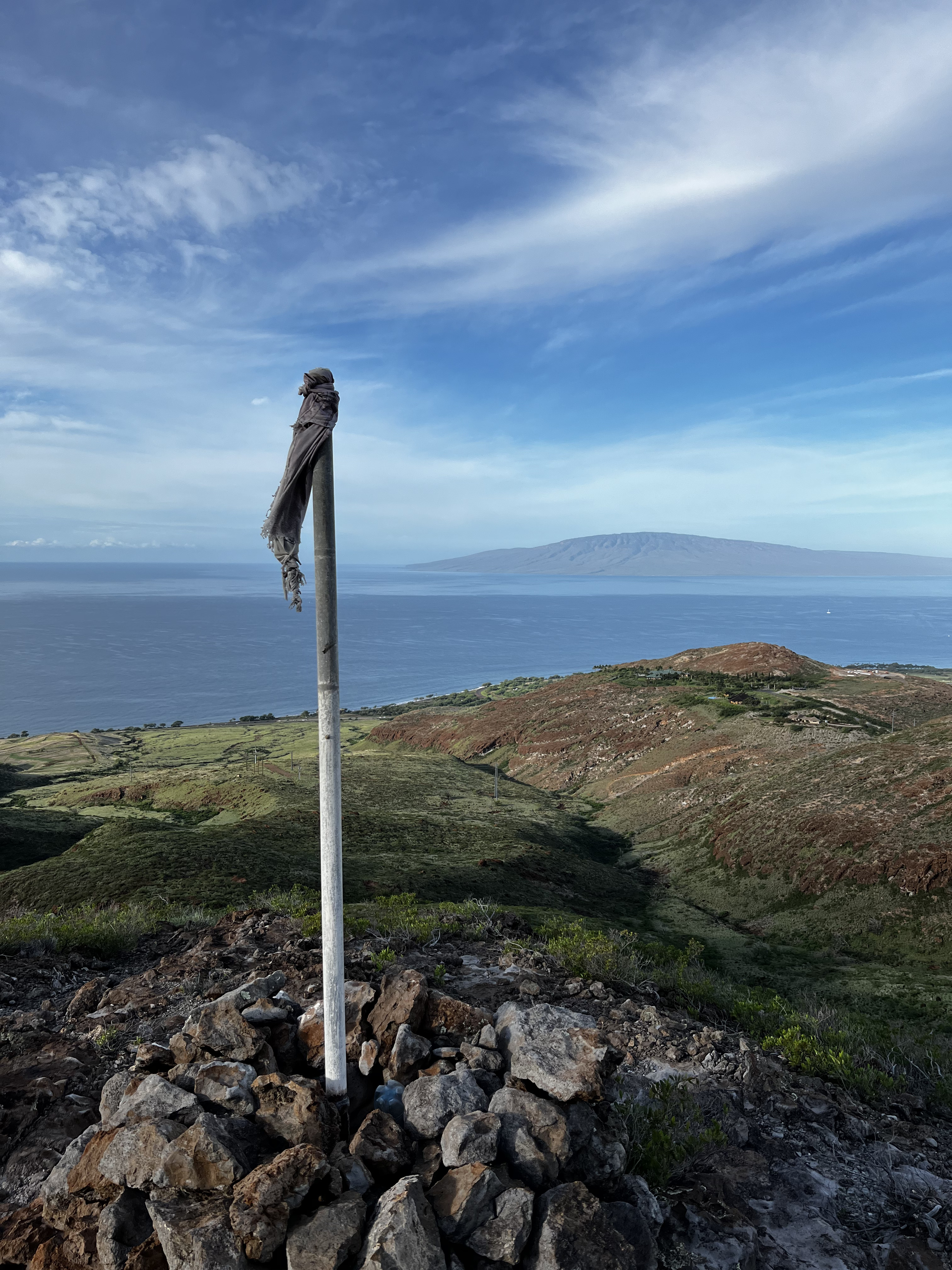
Somewhere up the way you’ll see a rock doughnut:
Congrats! You’ve made it. Feel free to use any of the rocks to build a cairn for the antenna mast. Remember to construct your antenna north to south so the wire can radiate east-west. After spotting I had great reception as shown later.
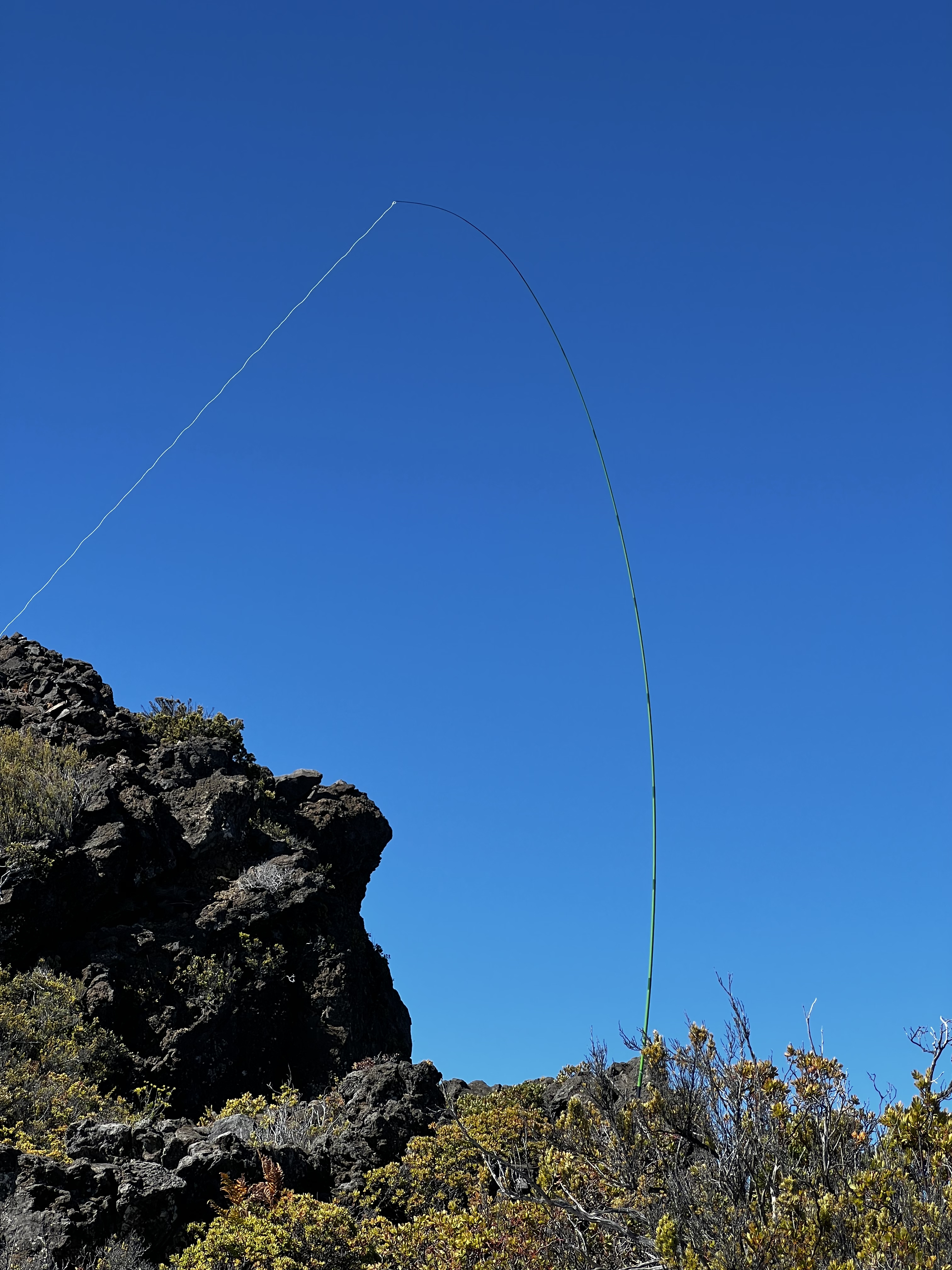 Antenna at the top
On the way down, be very careful of moving rocks. Remember to refuel on the way out, since you’ll be trudging uphill for 4 miles in the sun at least.
KH6/MA-009: Lihau
Following the recent activation reports, Lihau has been said as “deceptively hard” by K3OG. I parked somewhere near 20.831686, -156.638155 and set up for the excursion. My watch said only 6.5 round trip, so I was excited for a shorter journey.
 Lihau from the bottom
Long story short, Peter was right. It is deceptively hard.
You’ll accomplish your first mile on an unimproved road, then quickly switch to brush. Trudge through whatever pre-established routes you find until you get to a point of interest, a little mini summit with a marker:
 Lihau’s minisummit
Continue trudging up past a fence (stay to the left and avoid the marked-off areas) then your route will eventually get physically easier as you transition off of brunch onto loose, sliding rock. If you aren’t an experienced scrambler, this is where you turn around. Look off to your right - that’s a sheer cliff face. Keep three points of contact and a low center of gravity until you reach a safer location. Eventually the hike stables out and reaches up to the summit, but I stopped within the zone before the summit. Due to the recent storms, the route past a certain point was extremely unsafe. The state government actually put an 8-foot fence up to prohibit further scrambling just due to safety.
 Lihau from the a higher point up
Continue at your own risk. When I was doing this hike, I couldn’t look out into the valley or I’d get a little queasy. I didn’t get the best contacts at this location, but I also did it in the middle of a geomagnetic storm.
KH6/MA-008: Kapilau Ridge
Looking at the maui map, Kapilau Ridge actually seemed a little close to the road and Iao Valley State Monument. I corroborated three hiking guides online, and parked at 20.881995, -156.515016 to get to the hike. You’ll see it marked with Telephone Pole number 5.
The hike, for the most part, was well marked and solid clay. Don’t attempt this in or after any rainstorms or you will be knee-deep in mud.
The main feature to the hike was St. Anthony’s cross, but the trail continues for a little past it.
After another 1/4 mile, you’ll get to another thick 8ft fence. The property past this point is owned by the West Maui Forest Reserve. You are not allowed, under any circumstances, to trespass onto this property. I didn’t feel like getting in trouble with the law, so I turned around. The trail did continue past the ridge but I wasn’t risking 6 points over Hawaiian curses and ruining ecosystems.
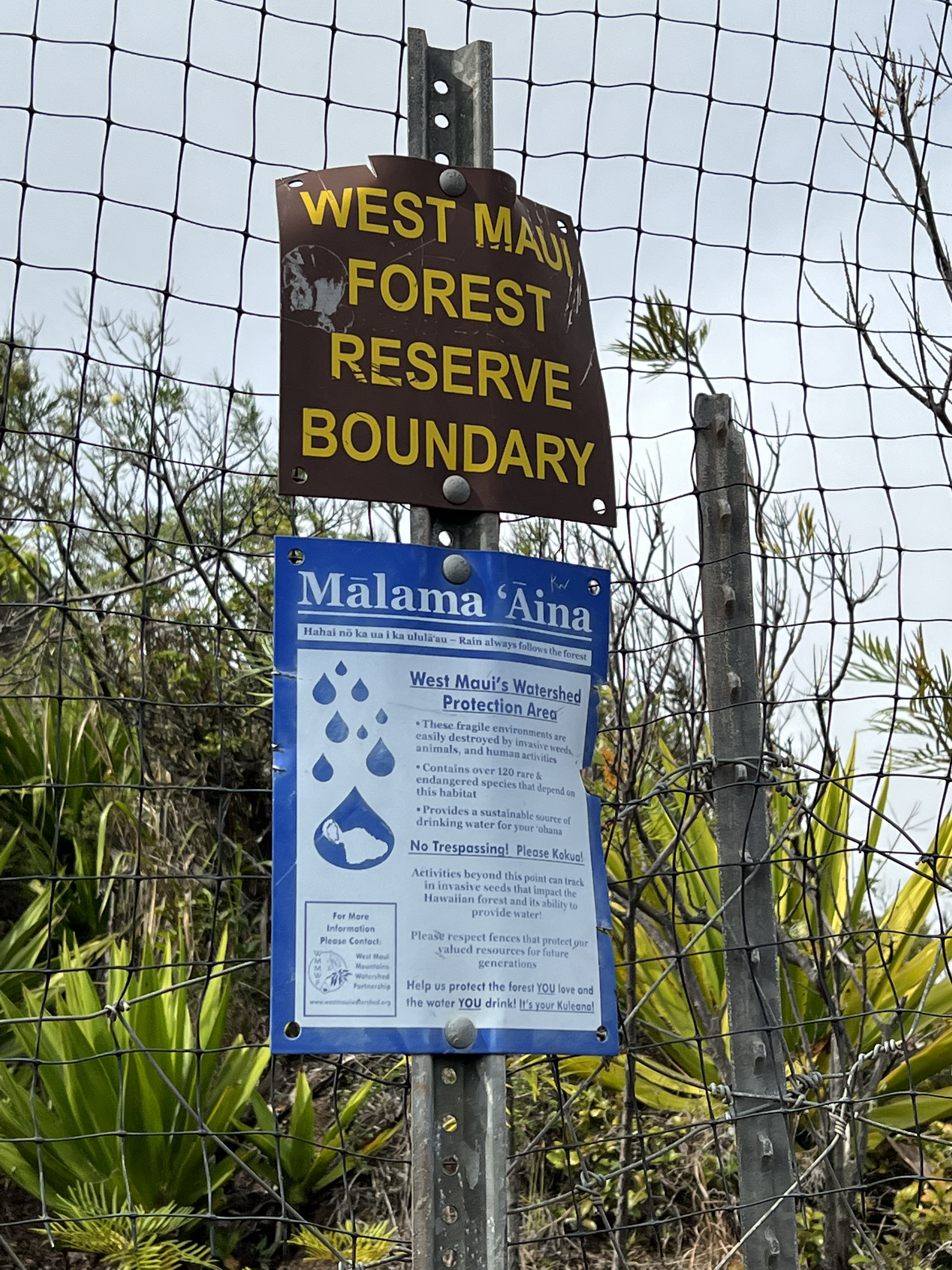 Kapilau Ridge’s “No Trespassing Sign”
K6/MA-001: Red Hill (Haleakala)
Red Hill is the highest point in Haleakala national park. The activation is very simple; drive up, park, get out, and activate. I set up in the visitor parking lot during the sunrise tour. I got to see the sunrise and operate HF - what’s more to love?
I encountered some issues with propagation before the sun came up, so I wouldn’t bother operating until sunrise. 20M was wide awake. Some friends said 30-10 was wide open the whole day. Enjoy the next few pictures, all courtesy of my brother.
 Haleakala with little light pollution
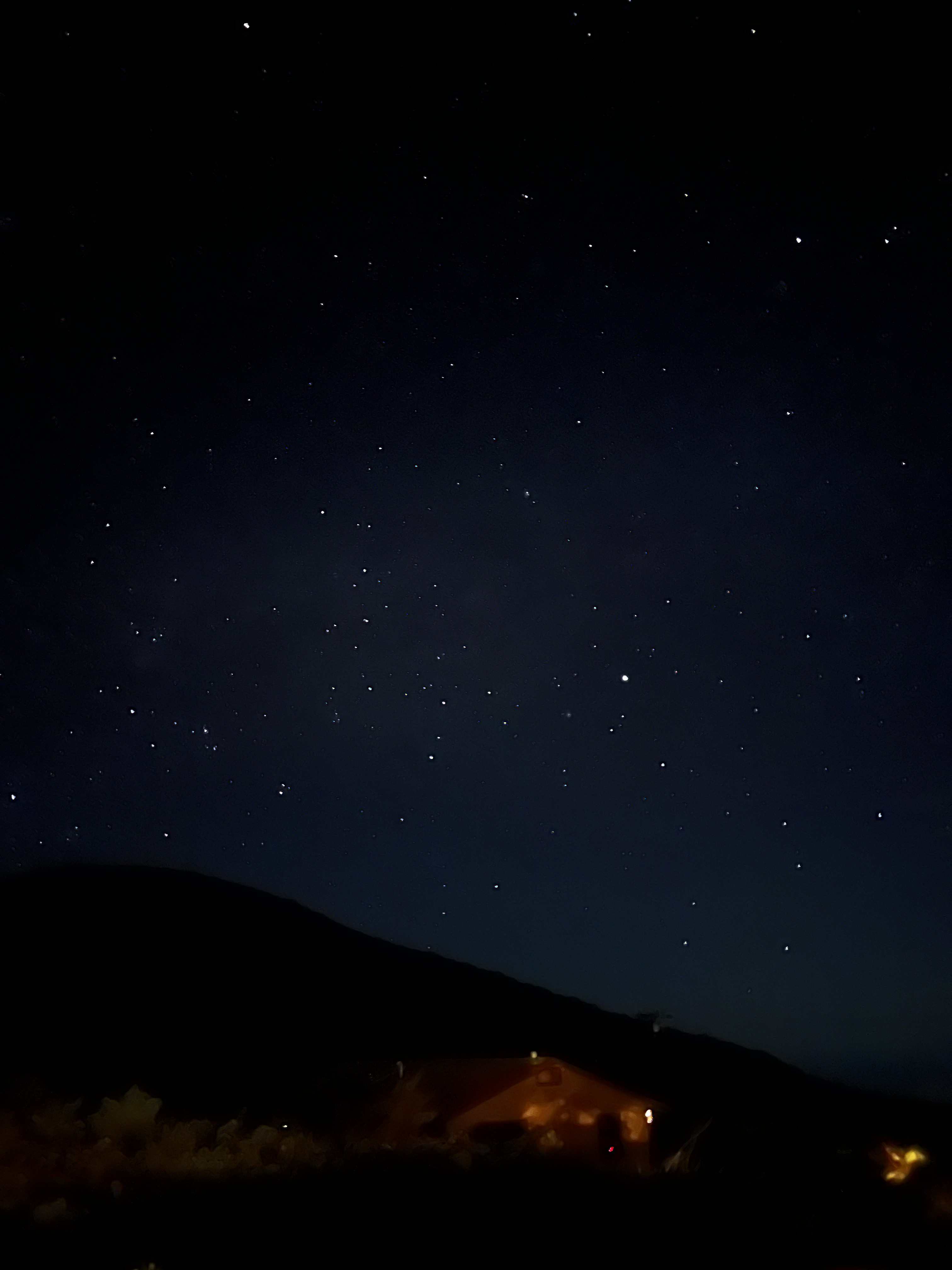 Stars again
 Stars and the sunrise
 View at the summit
 Sunrise View
 Some birds at the top
Equipment
I more or less now have a system I can use on any summit, at any time. I’ll be building the K6ARK EFHW soon, but the random wire works for now.
- The N2WU Case-X2
- The K6ARK Random Wire
- A telescopic fishing pole ala KE6MT. Post coming soon.
- Hard-shell Jacket and gloves. It gets cold at the top!
- CW Notebook and pen
- Custom-built Sideswiper Paddle with leg strap (blog post coming soon)
- 1L water
- APRS-Enabled TM-D72A
- Kahtoola Microspikes for winter activations
- 1 8oz. Fishing lure
- A GPS Watch with the course loaded
Total weight - 10 lbs. I brought everything I would possibly need up every time. I could make it to the US with 10W but not 5W of power.
Contacts
I operated APRS as N2WU-9. It only registered somewhat near the summits. Cell service worked on 8432 and Lihau, but not Red Hill.
I put an early SOTA Alert and sent an APRS SOTA spot and got on the map pretty quickly.
I operated CW 10W. Here’s my contact list and a KML generated with advice by Steve K2GOG using the ADIF-KML program.
KH6/MA-003 8432
| Callsign | Band | Time | Location |
|---|---|---|---|
| WB6POT | 20M CW | 2116Z | California |
| WW7D | 20M CW | 2119Z | Washington |
| W7GA | 20M CW | 2121Z | Utah |
| NW7E | 20M CW | 2126Z | Oregon |
| JHIMXV | 20M CW | 2128Z | Japan |
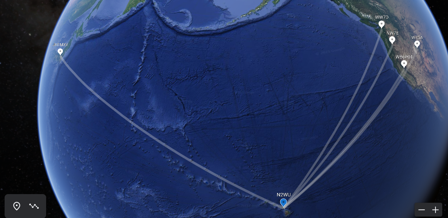 Google Earth Contacts
KH6/MA-001 Red Hill
| Callsign | Band | Time | Location |
|---|---|---|---|
| KT5X | 20M CW | 2115Z | New Mexico |
| NW7E | 20M CW | 2117Z | Oregon |
| F4WBN | 20M CW | 2118Z | France |
| ZL2IFB | 20M CW | 2120Z | New Zealand |
| W7GA | 20M CW | 2118Z | Utah |
| KF6HI | 20M CW | 2120Z | Arizona |
| W0MNA | 20M CW | 2118Z | Kansas |
| K7NII | 20M CW | 2120Z | Arizona |
| W0ERI | 20M CW | 2118Z | Kansas |
| W7RV | 20M CW | 2120Z | Arizona |
| KB7HN | 20M CW | 2120Z | Hawai’i - Big Island |
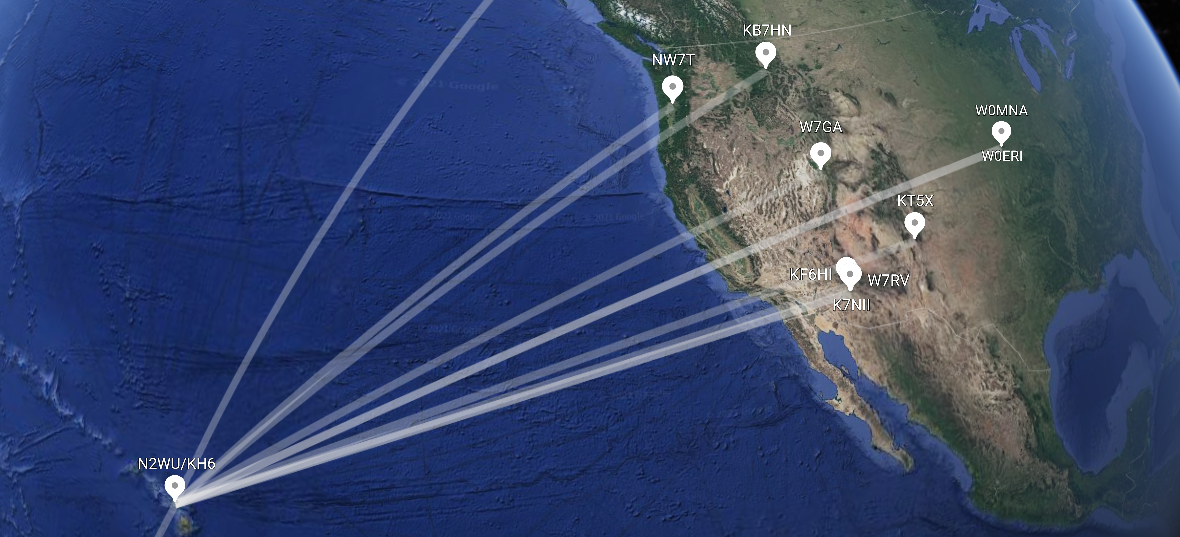 Google Earth Contacts: US
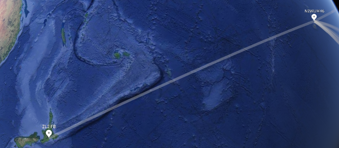 Google Earth Contacts: NZ
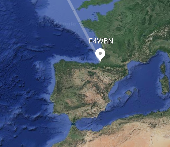 Google Earth Contacts: EU
Conclusion
I hope this guide helped clear up some mystery regarding the Maui summits. Remember to stay respectful of the land, and more importantly, knowledgeable of the laws!
-N2WU